Close the Information Gap in
River Logistics
BargeSwift transforms daily satellite imagery into up-to-date freight movement insights along the Mississippi River—helping you manage commodity risk, shipping delays, and climate disruptions, and infrastructure failures before they hit the market.
Contact Us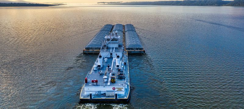
Supply Chain Disruption Begins with Missing Data
Current systems fail to capture the full picture of river freight—causing delays, price spikes, and poor decision-making.
- USDA weekly barge report is delayed by 7–10 days, and limited to select locks.
- AIS tracking only shows tugboats, not unpowered cargo barges.
- Climate events like droughts reduce river levels, barge load capacity, and shipping volume.
- In 2022, drought on the Mississippi River caused an estimated $20 billion in economic losses.
BargeSwift Delivers River Intelligence From Space
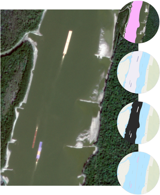
Our platform uses satellite imagery and patented analytics to provide timely, accurate barge traffic data.
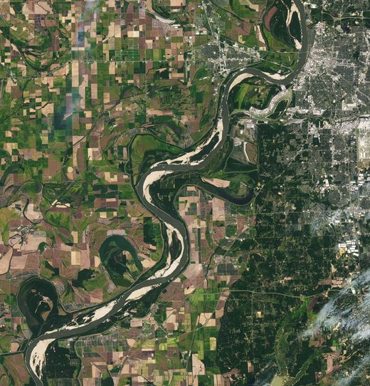
- Full Mississippi River Transport System coverage (upper and lower Mississippi River, Ohio River, Illinois River, Arkansas River, and Missouri River).
- Barge travel mode deletion (fleet size, barge numbers, upbound/downbound/parking).
- Near real-time updates with less than 24-hour latency, through a secure cloud-based API.
- Custumized inland waterway traffic summary.
- Integrates with existing tools for dashboards, forecasting, and operational alerts.

From River to Market: Actionable Insights for Key Players
BargeSwift enables users to respond faster, plan smarter, and reduce financial risk across sectors.
- Agricultural traders gain live insight into commodity flows and pricing conditions.
- Insurers and reinsurers assess exposure to river-based shipping delays and climate risk.
- Barge companies and ports improve logistics, scheduling, and fleet coordination.
- Government and infrastructure stakeholders obtain a more responsive monitoring system.
What Users Are Saying About BargeSwift
Don’t just take our word for it - hear from some of our satisfied users! Check out some of our testimonials below to see what others are saying about BargeSwift.
Lorem ipsum dolor sit amet consectetur adipisicing elit. Qui iusto illo molestias, assumenda expedita commodi inventore non itaque molestiae voluptatum dolore, facilis sapiente, repellat veniam.
Marvin McKinney
Web Designer
Lorem ipsum dolor sit amet consectetur adipisicing elit. Qui iusto illo molestias, assumenda expedita commodi inventore non itaque molestiae voluptatum dolore, facilis sapiente, repellat veniam.
Haha McKinney
Web Designer
Lorem ipsum dolor sit amet consectetur adipisicing elit. Qui iusto illo molestias, assumenda expedita commodi inventore non itaque molestiae voluptatum dolore, facilis sapiente, repellat veniam.
JJ McKinney
Web Designer
Lorem ipsum dolor sit amet consectetur adipisicing elit. Qui iusto illo molestias, assumenda expedita commodi inventore non itaque molestiae voluptatum dolore, facilis sapiente, repellat veniam.
CD McKinney
Web Designer